Modelling mines: how can a new 3D modelling platform make mining more sustainable and be part of the solution to climate change?
Despite public perceptions, mining is set to play a vital role in the planet’s transition to a sustainable future. Many low-carbon technologies, such as electric cars and solar panels, rely on metals that need to be dug out of the ground. Dr Laurent Ailleres, from Monash University in Australia, and his team are developing a 3D modelling platform that will help mines become more efficient and reduce their environmental and climate impacts.
TALK LIKE A GEOSCIENTIST
Orebody — a connected mass of ore (naturally occurring metals or valuable minerals)
Barren rock — rock that does not contain any useful metals or minerals
Stratigraphy — the layering present within a mass of rock
Lithology — the rock type defined by mineral content and textures
What do you think of when you hear the word “mining”? Do you think of black and white photos of tired looking men covered head to toe in dirt? Of pickaxes and minecarts or coal and dead canaries? Chances are, you do not think of the clean and green low-carbon tech of solar panels and electric vehicles (EVs). But the reality is, mining is as important today as it ever has been, and it will play an essential role in transitioning to a more sustainable future for our planet.
Metals such as lithium, cobalt, copper and nickel are vital components of many low-carbon technologies. All these metals are used in the manufacturing of batteries for EVs – for example, copper is essential to conduct the electric power to electric engines. Many governments around the world are putting a lot of faith in EVs to help them reach their climate targets. Both Australia and the UK, for example, are aiming to be carbon net-zero by 2050. In Australia, the Beyond Zero Emissions’ Electric Vehicles Report says a complete shift to EVs is feasible well before 2050. In the UK, the Climate Change Committee has recommended that all 49 million vehicles in the country should be replaced with EVs. With such ambitions, the demand for mining is likely to skyrocket over the coming years.
The problem, however, is that mining has traditionally had a detrimental effect on the environment. Mines consume a lot of energy and water when they are drilling and crushing rocks, which they do to extract metals and minerals. They also produce a lot of waste in the form of barren rock and contaminated slimes that can leech into the surrounding environment and pollute waterways, farmland and natural habitats. The water and energy used by a mine, along with the waste produced, is part of its mining footprint.
The challenge is to reduce the amount of energy and water needed and waste produced during the mining process, whilst simultaneously increasing the output of important metals. Dr Laurent Ailleres, from Monash University, has led the development of an ingenious new modelling tool, called Loop, that could help the mining industry rise to the challenge.
What is Loop?
Loop is an open-source (freely available) modelling software that can be used to create detailed 3D models of geological features that exist underground. For example, an orebody is a mass of rock within a mine that contains valuable metals. Loop enables mine engineers and geologists to model and map the characteristics of an orebody accurately.
These characteristics might include the types of ore that are present, as well as their density and distribution, along with the structure and condition of the surrounding rock. “These parameters have huge influences on how to extract and process the ores,” explains Laurent. If an orebody is modelled accurately, the whole process of discovery, extraction and processing the ore can be optimised. This would result in less drilling and a more efficient processing phase, which would, in turn, reduce the amount of water and energy needed, and the amount of waste produced.
How does Loop work?
Loop software makes use of geological maps that have been constructed from field data. These data are collected from surveys of the surface geology and drill holes, which allow geologists to build a picture of the subsurface rock. Drill holes can extend deep into the rock. However, their diameter is often just 5-10 cm. They produce samples that reveal how an orebody is layered (its stratigraphy) and other aspects of its lithology and physical characteristics.
Loop software combines these data to make predictions about the lithology and stratigraphy of an orebody. Once this is done, Loop can simulate other properties within the orebody using various geostatistical methods.
It is important to remember, however, that Loop relies on predictions and simulations to produce its models. “The results are highly uncertain, and it is essential that this uncertainty is characterised throughout the entire workflow,” explains Laurent. This ensures that all possible predictions have been considered.
The current method of building models relies on subjective interpretation of the field data, and this varies from one geologist to the next. Loop software builds models based on objective field data, ensuring the models it creates are as realistic as possible while fitting the data.

Reference
https://doi.org/10.33424/FUTURUM364


What are the benefits of this automation?
As well as removing the subjective aspect, Loop software can create models much faster than current methods. This means that testing different predictions and scenarios can be done rapidly, and better characterisation of the orebodies can be achieved.
Some of the parameters needed to create 3D models can be difficult, or even impossible, to measure in the field. Loop gives geologists the ability to build multiple models that use different values for these parameters, allowing them to explore all the possibilities in greater detail. “This is essential for understanding and quantifying uncertainty and mitigating risks,” says Laurent. By considering the uncertainty of a model, mine and exploration geologists can decide whether to move ahead with a project or whether they need to collect more data. Having sufficient data is essential for minimising risks, as using inaccurate models to make decisions could potentially backfire.
How can Loop models help reduce risk?
Having accurate 3D models of a mine gives geologists and mine engineers a more detailed picture of how it will interact with its surrounding environment. For example, mines located near important waterways can cause severe environmental damage. Rainwater and drainage can wash pollutants from a mine into nearby rivers and reservoirs, causing harm to the local wildlife and even putting human health at risk.
“What has more value in the long term – drinkable water or metals from the mine?” asks Laurent. “Is there a solution that would enable both to co-exist?” These are the kind of questions that Loop models can help answer. The models could also be used to monitor other polluting activities, such as agriculture, and advise on how best to minimise their negative impacts.
Why are community values important to Loop?
The team behind the Loop project is made up mainly of researchers and developers. For the project to be successful, a thriving and diverse community needs to be built. “Our community is growing,” says Laurent. “Users will provide feedback on what works well and what requires improvements.” In this way, Loop will be able to adapt and evolve to best suit the needs of the mining industry.
Laurent hopes that as more people start using Loop software, its benefits will become evident to a wider audience. As it is open source, it is accessible to a wide range of users. He explains, “We need champions in the community to demonstrate how Loop is actually reducing the mining footprint and improving subsurface resources management.”
What’s next for Loop?
The team’s current focus is on making the software easier to use and more accessible so that other groups can build their own models and answer their own questions. “The next big step is to start a not-for-profit company to make the development sustainable over time and less dependent on ARC funding,” says Laurent. If Loop can become self-sufficient and continue to expand its community, it could find itself playing a crucial role in the mining industry’s transition towards a more sustainable future.
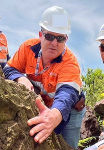 Dr Laurent Ailleres
School of Earth, Atmosphere and Environment, Monash University, Australia
Field of research: Geoscience, Computer Science, Mathematical Geology
Research project: Developing software that creates accurate 3D models of mine sites to improve their efficiency and sustainability
Funders: Australian Research Council (ARC); federal, state and territorial geological survey in Australia, exploration and mining industries
Collaborators: National (Australia, Canada, UK and USA) and Australian state and territory geological surveys, University of Western Australia, Université de Lorraine and d’Orléans in France, RWTH Aachen in Germany, the CSIRO and AuScope.
Q&A
Meet Laurent
What do you find rewarding about research in geoscience?
Over the years, I have had the chance to travel to many different places and meet people of many varied cultures. These encounters are always amazing and have made me a much more tolerant person. Our planet is beautiful, and the people inhabiting it are resilient and loving.
How will geoscientists contribute to solving future challenges?
Planet sustainability should be at the forefront of future research. Geology, maths, physics, chemistry and biology are all sciences that will be leading this research. Engineering will be important for developing and making the systems that will achieve a more habitable planet. There is also a lot happening in the realm of data science, however, basic geology research is still required and is essential for making use of the outcomes of data analytics.
Who or what inspired you to become a scientist?
My year 10 geography teacher taught us about plate tectonics, and that was it! As a kid, I was already collecting rocks and minerals, but without really understanding why, or what they were. I soon realised that I could combine my love for mountaineering, and mountains in general, with studies. Eventually, I studied my PhD in the French Alps, partly because I used to go there every summer.
What led you to focus on geoscience?
That lesson about plate tectonics was a eureka moment for me and is engraved in my memory. From then, I knew I wanted to study geoscience at university, and I worked hard to achieve that.
What attributes have made you successful in your work?
I have an interest in everything, which can be detrimental as you can touch on too many things without really making progress in any aspects. I am stubborn though, and I believe in my abilities to focus my research on what really interests me. I love fostering and developing relationships with younger scientists to help them develop as people. I love interacting with students, either as a PhD adviser or a teacher. Teaching in the field and in developing countries is so rewarding!
What are your proudest career achievements so far?
Leading the Loop initiative is something that I am very proud of. I have also taught in developing countries and worked as part of development teams for research programmes in Africa. Another part of my work that I find extremely rewarding is mentoring my PhD students and seeing them go on to have fantastic careers.
Pathway from school to geoscience
• Maths, physics, chemistry and geology are all essential for understanding the processes involved with our planet.
• Laurent says, “Be passionate, and follow wherever your passions take you.”
• Be pro-active and get involved with a research group as soon as you can. If you know a geologist, go and talk to them. If you live near a university, contact its geoscience department and see if there are any volunteering or work experience opportunities available.
Explore careers in geoscience
• Depending on where you are in the world, the Geological Society of Australia, the Geological Society (UK), and the European Geoscience Union are all good places to get information about careers in geoscience.
• Geoscience is just one of a whole range of Earth sciences. People of Earth Science is a website where you can learn about different Earth science careers directly from scientists’ experiences.
• Women in Earth and Environmental Sciences in Australasia has a ‘members spotlight’ section that showcases some of the amazing work being done by women working in Earth sciences.
Meet the team
Dr Lachlan Grose
Role: LoopStructural Research Lead
Field of research: Structural Geology
I wasn’t really exposed to geoscience throughout school and didn’t realise it was a potential career path, but I have always been interested in science. At university, I chose to study geology because it looked interesting and seemed to apply a bit of maths, physics and chemistry together. After my first couple of years doing geoscience, I knew it was what I wanted to do. I’m not a field geologist, but I’ve still been lucky enough to visit some amazing places, including La Palma in the Canary Islands, the Atacama Desert in Chile, and Kalgoorlie and Broken Hill in Australia.
In my third year of studying geoscience, I was really interested in geophysics and 3D modelling. During these classes, I was exposed to work on quantifying geological uncertainties, and this seemed to be a new area of research. I did my honours project on this topic, where my aim was to quantify the interpretive uncertainty that geologists make when drawing a map by comparing maps produced by undergraduate students during a field camp. Following this, I applied to do a PhD project. This involved trying to use structural geology to create 3D models of folds, which are a feature of some sedimentary rocks.
I am the leader of the 3D modelling component of Loop. There are two aspects to my current role. Firstly, I need to maintain and develop the 3D modelling code so that others can use it. Secondly, I spend time trying to solve existing problems with the methods we use for building 3D models. This often involves collaborating with other people and supervising students. I regularly work with colleagues in France, the UK and Canada. A typical day for me would involve spending the morning doing research and testing new ideas or writing. I usually spend the afternoons on the less exciting topics, administration and fixing bugs in the 3D modelling code.
As a chief investigator and work package leader for Loop, I have a lot of responsibility. I ensure that our 3D modelling tools are both innovative and user-friendly. It can be challenging to balance both aspects. It is very rewarding when attending conferences and workshops and seeing how many people have started to use Loop after only a few years of development.
I am proud of the growing uptake of the software that we have developed for 3D modelling. It is nice to see all the hard work being used and appreciated by members of the community. I find this more fulfilling than publishing papers that may or may not be read.
I hope that with Loop we can change the way resources are managed by building tools to be able to predict and quantify the geometry of geological features in the subsurface.
Lachlan’s top tips
1. Follow geological surveys and university departments on social media.
2. Doing an internship can be a great way to see if you enjoy working as a geoscientist.
3. Take any opportunities you are given. You never know where new experiences will lead.
Mr Roy Thomson
Role: Senior software developer and software architect
Field of research: Software Design
After floundering between different courses at university, I found that I both enjoyed and was good at understanding and writing computer code. This is something that my dad – who did programming and system design – suspected but didn’t want to force me into. The example my father set with his dedication to detail, seeking solutions to real problems, and letting me find my own path inspired me to pursue a career like his.
My current role is a combination of software developer, team leader and software architect, so every day is different. Some days, I am deep into code, finding a bug, writing new features, or rewriting code to be more efficient. Other days, I am reviewing other developers’ code or evaluating the structural design of a new module. On yet others, I am looking at the bigger picture of how data should flow from initial data collection in the field, through the process of creating models, to finally making recommendations for further research. This last part is the most nebulous as it requires researching a broad range of available software systems and emerging trends in technology, as well as the ability to decide when a promised technology or trend is too good to be true.
The focus of my career has been visualising information in understandable and efficient ways. As this focus is so general, I have been able to apply it to vastly different fields of study, from aerospace to Earth science. Given my interest in geological processes, the opportunity to work with Loop was perfect for broadening my knowledge and diversifying my career.
The greatest challenge for me is knowing when to stop looking for the perfect solution and, instead, choose the correct balance between efficiency, usability and resources. Specifically for Loop, there are a huge number of ways to create and compare 3D models and just as many technical solutions. While I would like to systematically experiment with each solution, this would be impossible due to the amount of time it would take.
The biggest reward for me is seeing my ideas and design come to fruition and making a difference in how an industry does things. There is quite a lot of excitement about our work within geoscience surveys and a revitalisation of 3D geophysical and geological modelling more generally. It is great to be part of it all.
Roy’s top tips
1. Find your passion and what you are good at. This can take time, but it’s worth exploring your options. If you find both in the same thing, make it your career.
2. Keep up to date with new technology, and look behind the hype into how it actually works. So many things are rebadged old technology that won’t work at scale.
3. Seek a variety of opinions as everyone has their own biases, including me.
Dr Angela Rodrigues
Role: Post-doctoral researcher
Fields of research: 3D modelling, Data Science, Mineral Resources
My family has a long line of stone masons; we are known by the nickname Pedras, which means “stones”. As a child, I was always familiar with rocks, and even had a small rock collection. Later, when I was in school, I learned how studying these rocks helps scientists unravel Earth’s history. That is what originally led me to pursue geoscience.
When I got a job as an exploration geologist, I had the chance to analyse datasets collected from drill-holes. How to mathematically describe an orebody underground from these datasets quickly became my passion. This is why I pursued a PhD under the supervision of a leading scientist in 3D modelling – Dr Laurent Ailleres.
On Loop, I am a post-doctoral researcher involved in building a 3D model of the Kalgoorlie terrane, located in Western Australia. A typical workday encompasses the analysis of geological data collected by the Geological Survey of Western Australia and its integration into a 3D geological model.
The most challenging part of working on the Loop project is to apply both mathematical and geological concepts in real world data. Most geological features are underground, so sometimes the geology we observe at the surface might not match the interpretations we make in the subsurface.
I am looking forward to being involved in the development of LoopResources, which will deliver an optimised workflow for characterising orebodies and, ultimately, developing more sustainable mining practices.
Angela’s top tips
1. Set yourself targets and stick to them. This will help you stay focused.
2. Explore different possible career paths before deciding which route to go down.
3. Find a mentor and discuss your options with them.
Mr Rabii Chaarani
Role: PhD student
Field of research: Structural Geology
My love of geoscience goes back to my childhood when I was impressed by the drawings of dinosaurs in my parents’ encyclopaedia. I read their story over and over for a big part of my childhood. When I got into high school, I chose Earth sciences as a specialty. Then I continued with geosciences at university, where I specialised in structural geology.
My PhD is focused on optimising field data collection for folded rock layers. I use Loop to run my experiments to find out how to optimise data collection. When I started my PhD, I was mainly trained to work in the field. With Loop, I learnt a lot about the computational side of structural geology. In the future, this will allow me to work on projects requiring fieldwork and modelling simultaneously.
My research will lead to efficient data collection for folded rock layers and increases confidence about their geometry at the surface and subsurface. After my PhD, I would love to work for a geological survey or in the industry where I can keep working with Loop and implementing the strategies I am discovering in my PhD.
Rabii’s top tips
1. Studying can be intense. Make sure to take care of your mental health as best you can.
2. Visit the Geology Page website for an excellent overview of various fields in geoscience: www.geologypage.com
Ms Fernanda Alvarado-Neves
Role: PhD student
Field of research: Structural Geology
As a kid, I watched TV shows about palaeontology and volcanoes. I have also always loved maths and science, so I decided to pursue a degree in geology. During my undergraduate degree, I learnt about many other exciting geoscience fields, such as structural geology, tectonics and hydrogeology. I realised how fun and fulfilling working in the field is.
My typical day involves coding, academic writing, reading and research, and meetings with my research group and supervisors. I am also part of the Women in Earth and Environmental Sciences in Australasia committee, so I spend some hours organising workshops and networking events for our community. During my PhD, I also had the opportunity to do fieldwork and present at conferences and workshops in Australia and overseas.
My PhD aims to develop a method to build 3D geological models of igneous intrusions. This method is part of the Loop platform, and the research team has been essential to my PhD outcomes. I had little experience in coding and 3D geological modelling before starting my PhD, so I have gained many new skills working with Loop.
Fieldwork and conferences have been extraordinary experiences, with much learning involved. When you work with 3D models, every time you visualise a model, and it works as you expected, it is a little eureka moment.
I believe my research will be a step towards a better characterisation of the Earth’s subsurface. This could be used for different goals, for example, assisting in finding new water and mineral resources, or developing maps for volcanic hazards.
Fernanda’s top tips
1. Always be open to new learning opportunities.
2. Be excited! A career in geoscience is super rewarding.
3. Explore all the different options within the field of geoscience.
Write it in the comments box below and Laurent and the Loop team will get back to you. (Remember, researchers are very busy people, so you may have to wait a few days.)