Practical activities to help geoscience students develop the skills they need to succeed
Traditional teaching methods that focus on the memorization and regurgitation of facts rarely lead to genuine learning. Dr Lisa Doner and her team from Plymouth State University in the US have developed a programme full of practical activities that allow their students to develop the skills needed for a successful geoscience career.
TALK LIKE A GEOSCIENTIST
Albedo effect — the reflection of sunlight from the Earth’s surface
Critical thinking — the analysis and evaluation of available evidence and arguments to reach a conclusion or create a new idea
Eutrophication — the process by which a body of water becomes enriched with nutrients, often leading to algal blooms and the creation of dead-zones
Watershed — an area of land that channels rainfall and snowmelt through streams and rivers and eventually into lakes, reservoirs or the ocean
Runoff — a major source of pollution, runoff occurs when excess water flows across the surface of land and into nearby streams, rivers or ponds, picking up toxic substances along the way. Nutrient-rich soil or water contains large amounts of nitrogen, carbon, phosphorus, sulphur and potassium
As all high school students know, learning new things can be challenging. Perhaps you have found yourself thinking, “Why would I possibly need to know about the second law of thermodynamics?” or “How is Pythagoras’ theorem going to benefit me in the future?” Reciting facts, memorising formulas and deciphering abstract concepts can feel tedious, confusing and pointless.
Traditional teaching methods that focus on the memorisation and regurgitation of facts have bored students for centuries. These methods rarely lead to genuine learning, with students often forgetting what they have learned as soon as the exam is over or their coursework is submitted. However, there are other ways of teaching that can help students truly understand new concepts and apply them in a range of situations.
For example, taking part in practical activities that require students to use scientific concepts can be a great way for them to cement their learning. This is particularly true if the activity is related to topics that are relevant to the students’ lives or local areas. This approach helps to ingrain knowledge and makes the concepts more accessible when students try to apply them in different situations.
The GeoPaths project at Plymouth State University in the US uses practical teaching methods to help its students learn. Led by Dr Lisa Doner, the project also provides mentors for its students and helps them find internships and develop skills that can boost their resumes and career prospects.
What is GeoPaths?
GeoPaths is an educational project designed to cultivate the scientific knowledge and skills needed to start a successful career in the field of geoscience. Plymouth State University is a predominantly undergraduate institution (PUI), meaning that its main focus is on teaching undergraduate degrees, rather than facilitating the research of professors and lecturers. As a result, students at PUIs generally have fewer opportunities to gain experience and skills in the more niche areas of science.
“Students who dream of studying glaciers,” says Lisa, “or exploring the deep sea or the moons of Saturn, might be discouraged with schools that don’t have instructors who can teach glacial geology, physical oceanography or planetary sciences.” These kinds of specialties are more common in schools that have a greater focus on research. The GeoPaths project is a way to give PUI students the practical skills and career opportunities they might not otherwise receive.
What are the aims of GeoPaths?
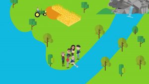
The overall goal of the project is to inspire students towards a career in geoscience whilst also building the critical thinking and technical skills that will help them along the way. Students enrolled in GeoPaths take part in a research project based around watershed areas. These are areas in which surface water converges at a single point, like a river mouth, or flows into another body of water, like a lake. Students enrolled on the GeoPaths project design, calibrate and analyse the data from monitoring devices that they use to study watersheds.
By engaging with the watershed research project, students are helping the local community understand more about their environment. The students gather and analyse essential data which helps to generate new knowledge about the local watershed system, such as how rainfall interacts with the land and how sediments are deposited in lakes.
GeoPaths students do not just gain practical skills from these activities. They can use these experiences to help them bolster their resumes and connect with other scientists, be that through their internships, post-graduate courses or professional careers. Students enrolled in the GeoPaths project are assigned mentors who help them make the most of these opportunities.
What role do mentors play in GeoPaths?
“Mentoring is about going beyond simple instruction when interacting with students,” explains Lisa. “It includes being aware of, and sensitive to, challenges that students may have in their lives that limit their ability to learn at the same tempo as students with fewer challenges.”
GeoPaths students come from a variety of backgrounds and so it is important that the mentors reflect this. “Students from non-white communities may not fully benefit from mentoring offered by an entirely white faculty,” says Lisa. “A sense of connection may be more easily accomplished if the mentors come from diverse backgrounds.”
The mentors engage the students in ungraded activities that are intended to build a student’s confidence when working as a scientist. Much of this is done by developing basic skills such as collecting and analysing data, performing calculations and using computer software such as Excel.
What other activities do GeoPaths students take part in?
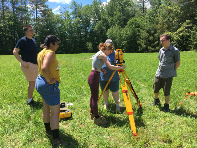
The activities offered to GeoPaths students provide them with a range of practical skills and experiences. There are field trips led by expert hydrogeologists, on which students study river overflow; snowpack assessments, in which students examine the layering and stability of fallen snow; and electronics training, in which students program software for temperature sensors. The practical skills that the students cultivate whilst doing these activities are likely to come in handy when they start their careers.
The GeoPaths project also helps its students take the first steps into a successful career in geoscience. Mentors help their students make connections with major research agencies and guide them through the process of searching and applying for jobs. Students are shown how to tailor their resume to their desired job descriptions and pick out areas in which they are making good progress, as well as areas in which they may need to develop new skills.
Reference
https://doi.org/10.33424/FUTURUM387
What skills are important for a successful career in geoscience?
As well as the practical, technical and professional skills gained from these activities, one of the most important skills is critical thinking. Specifically, critical thinking from a geoscientific point of view. “Thinking about the environment requires working in all of Earth’s spheres,” says Lisa. “Most environmental textbooks focus almost entirely on the biosphere, but by deliberately bringing geology to the forefront, we can introduce aspects of the environment that are otherwise brushed over.”
Take the problem of eutrophication, a process in which bodies of water are overloaded with nutrients that disrupt food webs and kill off wildlife. This is often seen as an entirely biological problem, but geoscience elements are also at work. For example, it is important to understand the role that soil plays in controlling nutrient-rich runoff from agricultural land, or what happens to nutrient-rich sediments when they are deposited at the bottom of lakes. Taking these elements of geoscience into consideration and thinking critically allows scientists to consider solutions more broadly.
What successes has GeoPaths had?
The success of the GeoPaths project is measured, in part, by the careers of its alumni. Of the six students who graduated from the first cohort, three progressed on to graduate school, one is working as a seasonal hydrologic technician, and another is a consultant at a geotechnical firm. Students from the second and third cohorts have completed internships and are well on their way to starting successful geoscience careers.
GeoPaths has also developed an exciting new research project that is used to help train students, teachers and the general public. This project, called MEERCAP, focuses on elements of geoscience that relate to climate change, and engages people from a much broader community than GeoPaths.
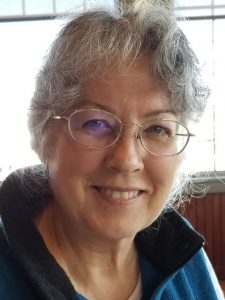 Dr Lisa Doner
Associate Professor, Center for the Environment
Plymouth State University, USA
Field of research: Geoscience
Research project: Developing an educational research program to help students gain the skills they need for a successful career in geoscience
Funder: US National Science Foundation (NSF)
ABOUT MEERCAP
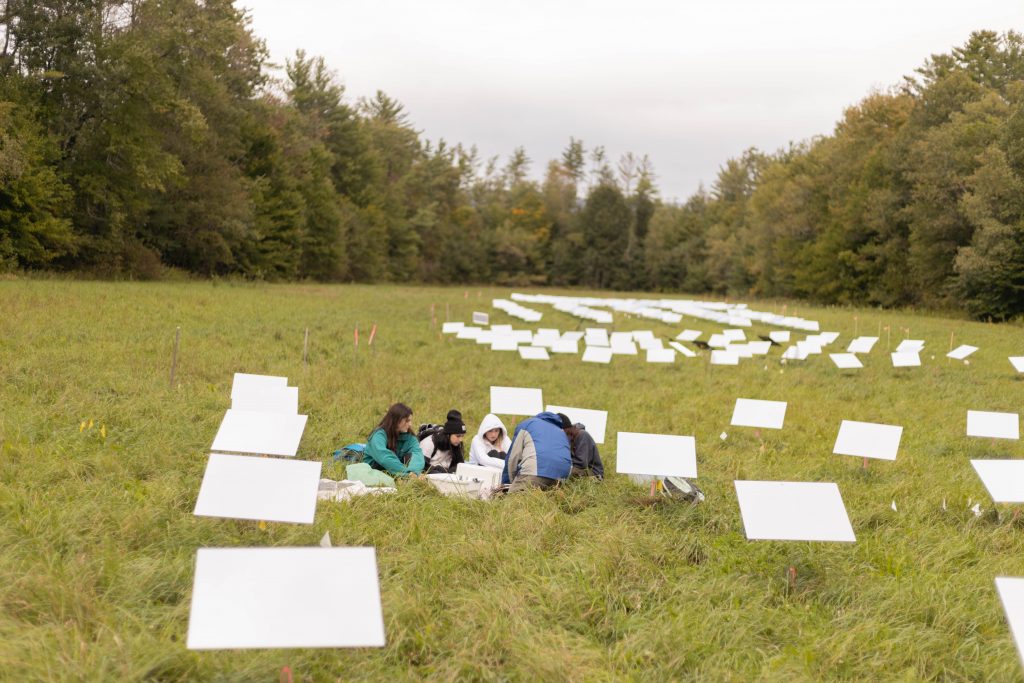
Mirror Exploration, Experimentation, and Reflection in Climate Adaptation Planning, or MEERCAP, is a field experiment developed by researchers at Plymouth State University. The project has been designed to investigate whether collections of mirrors can reflect enough sunlight to create a cooling effect in the surrounding environment, and potentially combat climate change.
“The earliest climate modelers understood that changes in Earth’s reflectance, or albedo, was a primary factor in causing cooling or warming,” explains Lisa. Light-coloured surfaces, like snow and ice, have a high albedo and reflect a large amount of sunlight away from Earth’s surface. In contrast, dark, non-reflective surfaces have a low albedo and absorb a lot of sunlight.
For decades, researchers have been investigating different ways of increasing the albedo effect, from painting roofs with white paint to releasing clouds of reflective particles into the atmosphere. MEERCAP’s approach, using collections of mirrors, is an affordable and easy-to-implement method of increasing the albedo effect on a local scale. Lisa explains, “Using mirrors improves on the effectiveness of the white roofs idea because mirrors have over 95% reflectance and can be aimed at the sun in the most-effective angle.”
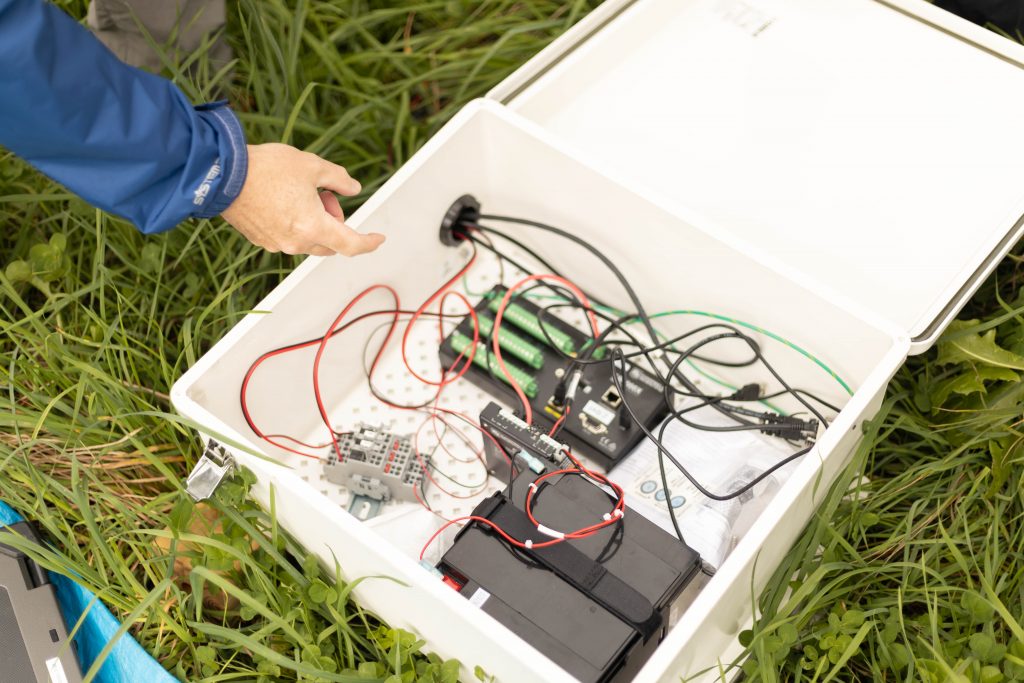
MEERCAP has two field sites, each with six plots. These include control plots, which have no mirrors, and experimental plots, each of which have a different number of mirrors. All the plots have an identical network of sensors which capture changes in ground temperature and soil moisture.
How are students involved in the project?
The third cohort of GeoPaths students were involved in developing the MEERCAP project. “As we worked on the project with the students,” says Lisa, “we realised how many additional, job-essential, training activities we could add to the student experience.”
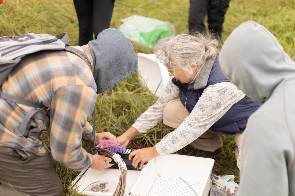
When taking part in the MEERCAP project, students help design the frames that hold the mirrors, set-up and repair the sensors, and write the programs that collect and download the data. “Going forward,” continues Lisa, “we anticipate that students will create and test their own research questions dealing with the interaction of the sun and the mirrors.” The MEERCAP project provides students with a chance to improve their critical thinking skills as well as develop additional practical skills.
Why are these additional skills important?
“Many children grow up without any practice in using tools,” says Lisa. Learning how to hold a screwdriver, wield a hammer and cut and shape materials like wood are important skills. “Almost every job outside of a desk setting includes an occasional need to work with such tools,” explains Lisa.
Most repairs to environmental monitoring sites are made by the researchers who use them. Students who know how to use hand tools will be able to apply these skills in problem-solving situations, which will make them valued employees. “Their knowledge in these areas can reduce maintenance delays and save the costs of hiring outside expertise,” says Lisa, who speaks from personal experience in field work.
Explore careers in geoscience
• Explore the Careers and Internships page on the US Fish and Wildlife Service webpage (www.fws.gov/careers). You can see the kinds of opportunities available to budding environmental scientists and apply for roles they are advertising.
• The US Fish and Wildlife Service also offers summer internships designed specifically for students. It provides a range of programmes in locations all across the US.
• The US Geological Survey offers internships to students at all levels of their education: www.usgs.gov/human-capital/students-and-recent-graduates
• Many other organisations and universities offer summer schools that focus on geosciences. Contact organisations and universities in your area to see what opportunities they offer.
• Even if universities do not offer summer schools, it is worth getting in touch with professors to see whether
Meet two GeoPath students
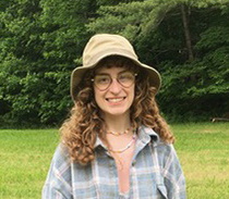
Emma Cox
Earth Sciences Student,
College of Earth and Mineral Sciences
Penn State University, USA
When I graduate, I’d like to do research about current climate change, study ice cores and climatological records, and receive my doctoral degree.
I took part in GeoPaths and MEERCAP because I wanted to gain real experience in laboratory and fieldwork research for climate sciences, especially since this project has so much potential.
I gained extensive knowledge of how experimentation and research happen in the real world through constant problem-solving, developing conclusions to help further the experimentation, and learning how to use new tools and software.
The thing that sticks out for me the most is the importance of collaboration when doing research. Teamwork is important for solving problems, coming up with new ideas, and getting tasks done more efficiently.
I would recommend a career in geosciences. If you love to learn about Earth through both physical interaction and scientific analysis, geoscience is a great path for you.
My advice is to try to save your notes and textbooks from classes and make connections with professors you like. It’s a wide field with many interesting niches. Explore the field of geosciences confidently, and don’t be afraid to ask questions.
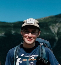
Myles Sornborger
Former Environmental Science and Policy Student
Plymouth State University, USA
When I graduated, my goal was to start a science career in New England. I am achieving that as a hydrologic technician with the White Mountain National Forest. I took part in GeoPaths because I wanted to gain real experience early in my college career.
Thanks to GeoPaths, I gained a head start in developing soft skills that everyone needs for a successful career, as well as many other skills that make my resume more notable.
I also received guidance on finding a career path that would fit me, and my relationships with my mentors have continued beyond the project. I particularly enjoyed the time I got to spend with my mentors and cohort, both in the field and the classroom.
If geoscience interests you, I would absolutely recommend it. The career opportunities are there. Get as much practical experience as you can and don’t specialise too early.
Do you have a question for Lisa?
Write it in the comments box below and Lisa will get back to you. (Remember, researchers are very busy people, so you may have to wait a few days.)

