What can Arctic rocks teach us about life on Mars?
On top of snow-capped mountains high in the Canadian Arctic, giant slabs of rock may hold the answers to an age-old question: is there life on Mars? Éloïse Brassard, a PhD student at the Université de Sherbrooke in Canada, studies a type of rock formation known as gossans. She aims to understand their geological characteristics and develop methods for detecting similar formations on Mars using satellite imagery.
Talk like a… Geomatician
Analogue — something that is comparable to something else. For example, an environment on Earth that is similar to an environment on another planet
Gossan — a surface rock formation characterised by its rusty appearance, resulting from the weathering and oxidation of highly concentrated iron sulphide minerals
Mineralogical composition — the types and proportions of minerals present in a rock or geological sample, providing insights into its formation, history and characteristics
Oxidation — a chemical reaction that takes place when a substance comes into contact with oxygen. For example, the weathering of iron sulphides exposes them to oxygen and moisture, producing rust
Remote sensing — the use of satellite imagery and other technologies to study and map the surface of the Earth or other planets from a distance
Spatial resolution — the level of detail in satellite images. A high spatial resolution is crucial for accurately detecting small features like gossans
Within the frozen landscapes of the Canadian Arctic, there exists a fascinating geological phenomenon: gossans – mounds of oxidised minerals that hold within them the clues to ancient geological processes. These formations, created through the weathering of sulphide minerals, offer a window into the past, providing insights not only into Earth’s history, but also into the history of other planets.
Éloïse Brassard, a PhD student at the Université de Sherbrooke, is working on the T-MARS project, which aims to study gossans as analogues to similar formations on Mars.
“Within the T-MARS project, my research is focused on developing a satellite detection method that could be used to identify gossans on Mars,” explains Éloïse. As she develops this method, Éloïse is also studying the mineralogical and geochemical composition of the Arctic gossans in her study area in Canada.
How can studying environments on Earth impact space exploration?
Studying environments on Earth is essential for improving space exploration. “According to the experts, given the excessive costs, risks and technological challenges associated with space exploration, the most viable alternative is to use the Earth to simulate other planets and moons as closely as possible,” says Éloïse. “Environments on Earth that present geological or environmental conditions similar to those found on other planetary bodies are known as ‘analogue sites’.” These sites provide researchers with the opportunity to conduct comparative studies, drawing parallels between Earth’s features and those observed on distant planets and moons.
Why is the Canadian Arctic an ideal model for Mars?
The Canadian Arctic has striking similarities to many environments and geological conditions found on Mars. “The environments on Earth that are most similar to the extremely cold and dry conditions that we expect to exist on Mars are terrestrial polar deserts,” says Éloïse. “The Canadian Arctic therefore provides the perfect opportunity to examine the physical and biological processes that take place in these environments, and to develop and test new technologies that may play a part in future Mars missions.” For example, geological field studies conducted on Axel Heiberg Island, a focal point of research in the region, have shown that its geological features closely resemble those found on Martian volcanic terrains.
Gossans are found across various climatic zones on Earth and are created when sulphide minerals in rocks react with oxygen and water. “Gossans generally range from a few metres to 1-2 km in size in the Canadian Arctic,” says Éloïse. “They may also exist on Mars since the environmental conditions were once favourable for their formation.” While gossans on Mars remain a hypothesis, their potential existence emphasises the importance of understanding the mineralogical and geochemical composition of gossans on Earth.
What clues do gossans hold about ancient life?
Beyond their geological intrigue, gossans have a remarkable capacity for preserving biosignatures – traces of past or present life forms or biological processes. “Gossans can preserve biosignatures in the form of mineral patterns, such as iron oxide filaments, or chemical traces, such as lipids from cell residues,” explains Éloïse.
The presence of iron-rich minerals within gossans acts as a preservative, prolonging the survival of these biosignatures by limiting enzyme activity that would otherwise degrade them. Moreover, certain sulphate minerals, like jarosite, found in Arctic gossans and in some places on Mars, serve as indicators of ancient environmental conditions, particularly the presence of liquid water at specific geological epochs.
“As the Earth is the only place where traces of life are known to exist, it is essential to study biosignatures in order to understand how they were created and preserved,” says Éloïse.
How is Éloïse analysing gossans?
Éloïse uses a multifaceted approach to study gossans, beginning with the collection of samples from the Canadian Arctic. She then analyses these samples, with a focus on measuring their reflectance – the proportion of solar radiation reflected for each wavelength in the electromagnetic spectrum. Analysing the samples in this way allows Éloïse to identify which minerals they contain and capture their distinct ‘signatures’, which she uses to locate and map gossans from satellite images.
However, this method has its limitations. A primary challenge lies in the spatial resolution, or the level of detail, provided by satellite images. “With current technologies, multispectral images with good spatial resolution contain less spectral information – fewer wavelengths for which reflectance is known,” explains Éloïse. “This causes the detection of false targets, which have a signature similar to gossans in the available wavelengths.”
To overcome this issue, Éloïse uses hyperspectral images which contain more information from across the electromagnetic spectrum. These images have lower spatial resolution and can look blurry, but they enable Éloïse to distinguish gossans from false targets. This hybrid approach enables the precise mapping of gossans by combining the detailed spatial information of high-resolution multispectral images with the spectral richness of hyperspectral images.
What is next in gossan exploration?
“The next steps are to apply our remote sensing method to other gossan-rich regions in the Canadian Arctic to validate the results and reduce uncertainties,” explains Éloïse. “We will then test this method on satellite images of Mars, potentially identifying areas with properties similar to terrestrial gossans, which would be prime targets in the search for traces of ancient, extra-terrestrial life.”
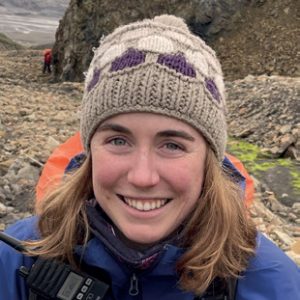 Éloïse Brassard
PhD student, Department of Applied Geomatics, Université de Sherbrooke, Canada
Field of research: Applied geomatics
Research project: Analysing gossans in the Canadian Arctic to develop new techniques for detecting similar structures on Mars
Funders: Canada Research Chair in Northern and Planetary Geological Remote Sensing, Canadian Space Agency, Fonds de recherche du Québec – Nature et technologies, Natural Sciences and Engineering Research Council of Canada, Polar Continental Shelf Program, Northern Scientific Training Program
About geomatics
Geomatics is an interdisciplinary field that utilises various scientific, technological and mathematical principles to collect, analyse and interpret geographic data. It integrates elements of geography, cartography, remote sensing and computer science to address a wide range of challenges related to spatial data management and analysis. Geomatics professionals use advanced tools such as geographic information systems (GIS), global navigation satellite systems (GNSS), and image processing and analysis software to address spatial challenges across various industries.
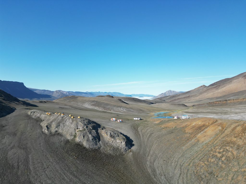
Conducting fieldwork is a challenging yet rewarding aspect of geomatics that often involves going to remote locations to collect important data about the Earth’s surface. “The challenges are mainly related to the logistical and scientific planning of expeditions to remote regions,” says Éloïse. “We have to start preparing at least a year in advance in order to obtain authorisation, plan transport, equipment and food, and consider any unforeseen circumstances that may arise in the High Arctic, mainly due to the weather.”
However, overcoming these obstacles often leads to the rewards of discovery, as researchers have the opportunity to explore breathtaking landscapes, engage in team adventures and contribute to scientific knowledge. Beyond its applications in geology and planetary science, geomatics plays an important role in addressing societal challenges and improving everyday life. “Think of monitoring forest fires or coastal erosion, modelling demographic phenomena, mapping global deforestation, monitoring flood risks, visualising underground infrastructures using augmented reality or optimising the routes of emergency and public transport vehicles,” says Éloïse. “As soon as a phenomenon has a position on Earth (or elsewhere in space), we call on geomatics.”

Reference
https://doi.org/10.33424/FUTURUM498


Pathway from school to Geomatics
“Geomatics lies at the intersection of science, technology, engineering and mathematics,” says Éloïse. “To achieve a career in geomatics, it is important to have a basic understanding of a variety of subjects, such as mathematics, physics, computer science, Earth sciences, geography, urban planning or ecology.”
At college or university level, you can specialise in geomatics-related disciplines such as geospatial science, data science, remote sensing, geographic information systems (GIS) or cartography.
Look for internships or summer programmes offered by universities, research institutions and companies involved in geomatics. These opportunities provide hands-on experience and exposure to various aspects of the field.
Offer to volunteer for projects related to geomatics in your community or local organisations. This could involve assisting with mapping projects, environmental surveys or data collection initiatives.
Explore careers in geomatics
There are diverse career opportunities available in geomatics, ranging from environmental monitoring and urban planning to natural resource management and disaster response. Professionals in the field can work in various sectors, including government agencies, engineering firms, research institutions, environmental organisations and technology companies.
Some useful websites to learn about geomatics include Modernizing Geography with ArcGIS, a blog series featuring interactive web-based activities related to geomatics, and ArcGIS Living Atlas of the World, where you can explore a collection of geographic information from around the globe including maps and web apps.
Find out more about what it’s like to be a professional geomatician and learn about the varied work that this field has to offer by reading this blog.
Meet Éloïse
Before entering university, I took two geology courses at a preuniversity programme in Quebec. The teacher of these courses was a passionate geologist and an excellent educator. I quickly discovered my interest in the field of Earth sciences and was thrilled to learn that it is a fully-fledged area of study.
During my bachelor’s degree in geology, I took a course titled ‘Geological Cartography and Geomatics’. I loved how cartography (the study and practice of using maps) allows us to visualise and understand the territory at various scales, as well as the practical applications of geomatics. I decided to pursue a bachelor’s degree in geomatics before completing a master’s degree in applied geomatics and remote sensing.
In geomatics, some projects aim to process existing data, while others require the collection of new data. I am driven by new experiences and adventures; that’s what motivates me to put in the hard work every day to pursue my passions and why I chose to work on a project requiring fieldwork. This choice led me to participate in two scientific expeditions to the Canadian Arctic, where I collected the data and samples that form the foundation of my research.
I’m just starting my PhD, where I’ll dive into the search for potential areas suitable for gossans on Mars. By combining data from various sources, including our gossan remote sensing method, I’ll be conducting a geospatial analysis of the landing regions of future rovers. In the bigger picture, I aspire to team up with various other researchers to deepen our understanding of gossans and how to detect and map them using remote sensing. Beyond that, I’m fascinated by analogue environments, so I aim to expand my expertise to other parts of our solar system by studying and exploring different analogue environments here on Earth.
Éloïse’s top tips
1. Don’t be afraid to explore different subjects and experiences to discover what truly excites you and keeps you eager to learn.
2. If a particular subject or field sparks your interest, reach out to professionals in that area. Consider doing an internship or project with them. Building connections can open doors you might not have imagined.
3. It is perfectly normal to change directions in your studies. The knowledge and skills you gain along the way are never wasted, and they often contribute to a broader perspective.
Do you have a question for Éloïse?
Write it in the comments box below and Éloïse and the team will get back to you. (Remember, researchers are very busy people, so you may have to wait a few days.)
Read about how analogue sites can be used to hunt for extraterrestrial microbes:
www.futurumcareers.com/what-if-microbes-could-live-in-extreme-environments-beyond-earth
0 Comments